Sunday, October 29, 2006

Milagrosa Canyon


Tucson, Arizona
This was the second time I rode this trail. The first time was in May just before it got too darn hot around here. At the time, I thought it was the best trail in Tucson. Well, this time, my feelings have changed.

Part of it could have been physiological: I didn't get enough sleep, eat enough food, and I rode Fantasy Island late the day before. The other part of it could have been that my Kona is much heavier than my old hard tail and there's a lot of climbing on this trail -- nearly 3000 feet -- if you do it my way. Finally, the trail wasn't as smooth as I remembered it. I was walking a lot more than I did in the spring, on the ups and the downs.

That said, it is still a killer trail and a great adventure. It's the kind of trail that you feel really good about finishing.

The day I went it was cool and overcast. Once you get over that ridge you suddenly feel so remote. Don't hurt yourself. You've got ten hard miles ahead of you.

How to get there: Take Tanque Verde Road. Turn right on the Catalina highway. Turn right on Snyder, the last street before you hit the mountain. Cross Soldier Road and park at the end of Snyder.

Length: 20 miles, 3-4 hours, 4000 foot climb.

Trail Conditions: Dry. Pretty rough. Lots of loose rocks right now.

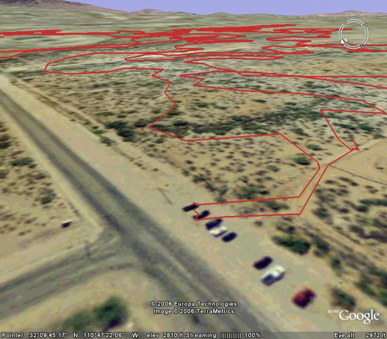
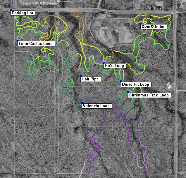
The Map: Check out my Motionbased map below. There's also a good map at SDMB.
Map of Milagrosa Canyon

The Ride: From your car, head up Soldier Road until it meets the Mt. Lemmon Short Road. Take that up to the Catalina Highway and ride 7 miles to Prison Camp. From Prison Camp, you follow signs to the Bellota Trail which takes you over a hill and into the Molino basin. This is some fun singletrack. When you get to the campground, cross the Catalina highway and follow the Bellota Trail (part of the AZ trail) up and over the ridge. This is super steep and technical and there are these annoying rubber erosion mitigation strips. Although I pooped out this time, I remember staying on my pedals for most of the climb in the Spring. Once you get up the ridge you go through a green gate and begin a technical descent. Lots of dropoffs, switchbacks, and some serious exposure. The trail will flatten out, and you'll cross a little valley. Then, you climb briefly and descend again. You head past a water tank, cross a wash, and go through a second gate. Finally, you'll be on some doubletrack and you will come to a sandy wash. You have to look carefully to see the Milagrosa trail on the right. It is not marked. You know you're on it because you'll be carrying your bike up and over some sand and rocks before you can really ride. Take this all the way along a gorgeous ridge. Watch out for prickly pear and derailleur snapping rocks. As you come to the end, you'll notice a steep red canyon to your left, the trail will veer to the right and descend a fun slickrock section. You cross a wash and climb again, head through one last green gate, and the trail hits some doubletrack just below a few houses. You can find your way back to your car from here.

Saturday, October 28, 2006

Fantasy Island


Tucson, Arizona
It is what it is. Tucson's humble dirt playground. Some gulleys. Some banked turns. It's prettier than it looks. Sometimes when you're weaving between the fingers of a giant cholla, you forget that you're smack in the middle of Tucson's suburban wasteland.

How to get there: The main entrance is at the corner of Irvington Road and Harrison Road. Beware: windows are frequently smashed.

Trail Conditions: The monsoon season did this place no good. Lots of ruts and loose rock. Not nearly as smooth as it used to be, but it seems to be getting better.

Length: 11 miles, 1 hour

The Map: Check out the map posted at the trailhead. Another good map is located here. Or you can check out my my map from Motionbased below.

Map of Fantasy Island

The Ride: The trail is one-way and pretty self-explanatory. You ride the Cactus loop for about 3 miles. There, you'll see signs for the Bunny Loop, a long flat bunny-ear of a trail that I usually skip. Keep going another mile and take the turnoff for the Chirstmas tree. It's a fun 2 mile jaunt and has a great patch of red soil that feels like you're on Mars. It'll spit you back at the Cactus loop. There, you can take the Burro loop (3 miles) to Bo's loop (2 miles), eventually bringing you back to Cactus and the trailhead.

Sunday, October 22, 2006

Chiva Falls Italian Loop

Tucson, Arizona
I rode the Chiva Falls "Italian Loop" yesterday. I'd been holding out for a while because I knew it was an OHV playground with miles and miles of doubletrack and scant singletrack. Finally, I cracked after rereading glowing reviews on MTBR. Alas, it was a boondoggle.

How to get there: From Tucson, head to the end of Tanque Verde Road where it turns into Redington Road, a rough dirt road. Go 4.7 miles until you see a corral on the left and FR4417 on the right. Park Here. (Google Earth)

Length: About 12 miles or 1.5 - 2 hours.

The Map: First off, I downloaded a bogus map from Scott Cherba's website when I should have gotten the newer OHV map from the Forest Service site. Luckily, the OHV map is posted throughout the road system, and getting lost isn't really an issue here -- as long as you have plenty of time.

The Ride: At about 3:30, I started at the parking lot where 4417 hits Redington Road and headed up Reddington Road 5 miles until I got to the turnoff for FR37. FR37 is a rocky, rolling descent until the flatter floodplain on the upper reaches of Tanque Verde wash. I turned right at FR4424 and in about a mile I took a left at FR4417. FR4417 is more of the same: some steep ups and downs until FR4426 comes in from the left. Here, you can take FR4426 to 4405 and check out Chiva Falls, but I was short of time and took FR4417 back to my car. I had to navigate around a convoy of middle-aged jeep enthusiasts and only ran out of steam on one steep uphill. There are some pretty sweet jumps along the way, but all in all it was a pretty dull ride. I was back at my car by 5:15.

Next Time: The ride was shorter than I thought it would be and now that I know the geography better, I'll probably take the Italian Springs Trail #95 to FR37. Then, that "foot trail" between FR37 and 4426 looks appealing. I'll take that to Chiva Falls and then head back via FR4417.